
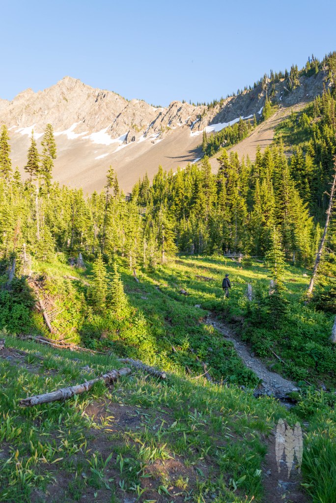
The moment we crawled onto a flat that weaved into a beautiful alpine meadow, I was fairly certain I hated backpacking. This was after we’d enjoyed the expansive Jack Mountain and the Nohokomeen Glacier. This was after I sat in the shade, listening to Sooty Grouse boom, and turned to see a snowshoe hare hopping down the trail. Despite these things, I still couldn’t determine why I thought 7 miles and 5000 feet of elevation gain, with a backpack for 4 days of camping, was a good way to spend some time off.
Type two fun is one name for such approaches. My left hip had started to spasm in cramps and I couldn’t seem to walk without stopping to wheeze. Truth be told I was out of shape, but this was definitely harder than I’d imagined. When we finally broke the treeline and sat down alongside a stream that dropped through lime green meadows, filtering some much needed and deliciously cold water, we were met with a cloud of mosquitoes. How can a place be simultaneously so beautiful, yet so ruinously uncomfortable?
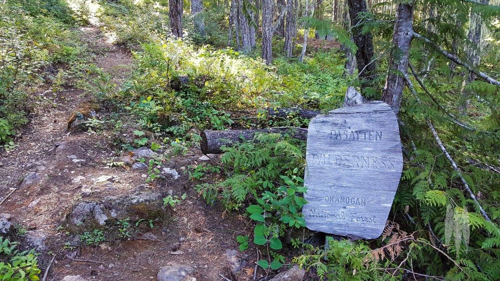
The wilderness boundary on Devil’s Junction from Ross Lake.
Sam, had been pushing for us to hike Devil’s Dome Loop in the Western Pasayten Wilderness for years. He is a friend from high school, and one of a group who gets out hiking together at least annually. I’d had no objections, but the first attempt was foiled by fire near where I currently go to school, in 2015. Then came years where it didn’t quite make sense with our schedules, so we went to the Eastern Pasayten early season, or circled the Goat Rocks Wilderness. I may or may not have forgotten the challenge those hikes presented. Yet, I cannot imagine my life having not strode up the great open flank of tundra on Armstrong Mountain amidst tinkling Horned Larks, or crawling out to the perilous perch atop the jumbled summit of rocks that is old Snowy. These were things worth doing, even if you forgot the pain.

A panorama of Jack on our hike up from Ross Lake. The big patch of “snow” on the left flank of the peak is the Nohokomeen Glacier.
There was a moment during the hike up where I wasn’t sure I was going to make it. We were staring up at Devil’s Dome and from our perspective, it seemed impossible. I stopped looking at the wall of rock and focused on my feet, taking small steps and measured breaths. Usually I splatter my gaze across the trail and the world around me. That’s how I spotted the Northern Goshawk that flew by earlier, or picked out a male Sooty Grouse displaying from a log in the shadows of subalpine firs. For now, it was time to focus on the energy I had left and stagger atop the fucking dome.
Somehow, the last moments before reaching a summit, your feet begin to lighten. I’m no mountaineer; that’s never going to be my thing. And, I still I know what it’s like to push my limit for a summit and then feel the burning lift away as the top levels out. After a solid six hours trudging uphill, we’d finally hit the peak.
What motivates me to backpack isn’t the challenge, it’s to see what’s out there. What is happening in the lives of the organisms, at this moment in time, during this year, in this obscure place? Who do I expect to see, yet find no trace of? Who will surprise me? Who am I trying to pretend I am not searching for every moment of every second we are hiking, in the hopes that fate will toss one across our path? The views don’t hurt either.
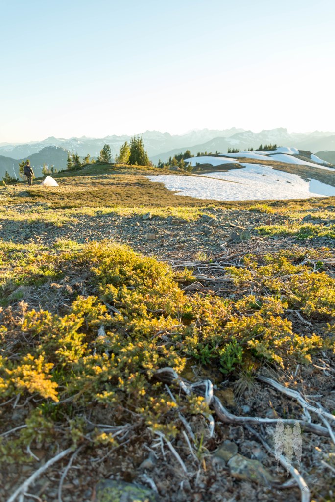
Our first camp was complete with a beautiful view, but I was also captivated by the plants and animals making a living up here. This patch of juniper must spend at least half its year under snow, and yet, here it is doing just fine. Sometimes I think I take on these challenges to be continually humbled.
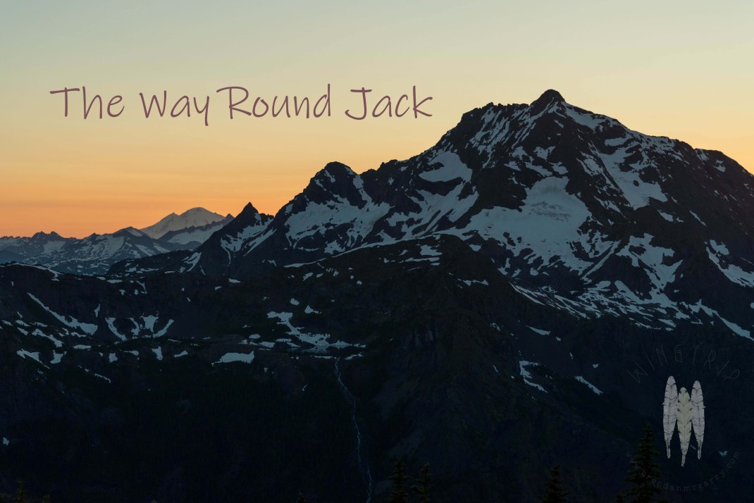
Jack Mountain is the spire you circle around on the Loop. This hike could also be called The Many Faces of Jack. At 9017 feet, it is a very tall mountain by Washington standards, and one I’ve seen countless times as I’ve driven back and forth across Diablo Dam during the past year. Admittedly this was from the southwest and no glaciers or snowfields were visible from that aspect.
Much of the settler history in this part of the Upper Skagit sits in the shadow of this peak. The mountain itself was named after Jack Rowse, who had a mining claim along Canyon Creek. Henry Custer was the first topographer to describe the mountain, while surveying the area in for the Northwest Boundary Commission in 1859. George Holmes, a freed slave from Virginia, had a mining claim in Ruby Creek drainage that he acquired in 1895. He operated this until 1925, toiling in solitude on the southern flank of Jack. I can say next to nothing of the women who knew this peak during that period of history. I can only assume Lucinda Davis, at her roadhouse on Cedar Bar knew of Jack’s immensity well, if not intimately. Similarly I know nothing of the indigenous relationship to the peak, but it is difficult for me to believe it hasn’t played a significant role for people who have traversed these rugged hills since time immemorial.

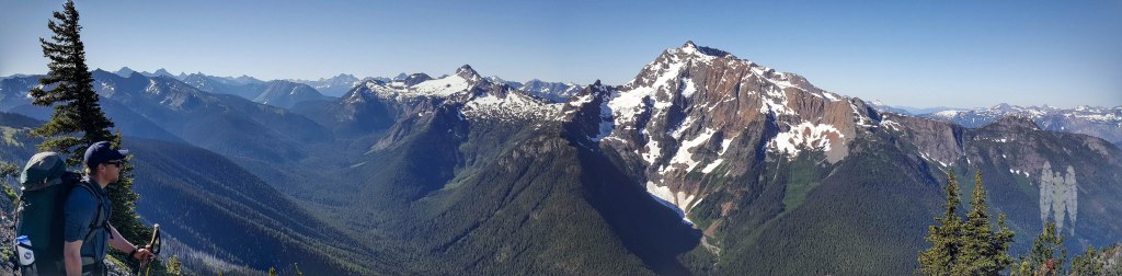
Crater (left foreground) and Jack (right) from Devil’s Dome.
Jack is formidable and it drew our attention as we watched the sun glissade down the sea of peaks that is the North Cascades. Yet, we weren’t there just to stare at a big peak. Jack was merely the foreground to the spread of peaks with names I knew, and other names I didn’t. I was drawn away from this vision by the twittering of Vaux’s Swifts, a group of six that drifted up to this elevation, presumably for an evening snack. For some reason I felt an affinity for this ascent and yet utterly feeble by their seemingly easy climb. Surely they would descend to a roost tree, while we sat among the alpenglow, almost unable to move.

Sundown over the snow on top of Devil’s Dome.
I woke up sore, stiff, and much later than I would on a typical backpacking trip. Hermit Thrush whistles still rose from the treeline as I crawled out to greet the day. With the enormous view from the highest point of the trail, we were in no hurry to get underway and sat with our morning vittles as the sun crept over the horizon to our backs.
The snowfield on Crater Mountain, a slightly lesser mass to Jack, was entirely pink with snow algae, and visibly so with the naked eye. Baker hid behind the mountains I drove beneath every day. I finally saw Mount Ross as a snow covered peak instead of a rocky wall, as viewed from Newhalem. Big Devil looked like a volcanic cone enough to confuse me considerably, nothing like the snowy talus slope I see from Highway 20. There were so many jagged summits stretching into Canada, I had no hope of remembering them all. It’s much better to surrender to the sea instead of playing the name game.
Finally it was time to get saddled up. We’d already seen more people than we expected, several early morning hikers, as well as the woman who’d snagged the best spot on the dome the night before. This place felt remote, but we were concerned that other camps might be occupied.

Hiking south off the Dome.
The hiking was easy as we got off the Dome and wound down the ridgeline. The Pasayten, to our left, was brown, the orographic effect vividly displayed, but we were also seeing a different geologic mixture that added to the feeling of a water scarcity. Where we stood it green and this carpeted the mountainsides up to treeline to our right and west.
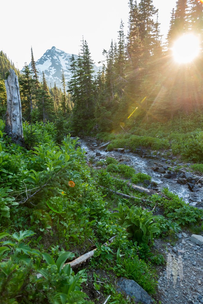
Passing from trees to meadow, we felt it heating up and began to get a little worried about water. Our map had a spring marked on it at Devil’s Pass, but there was no other evidence of water, snow having recently disappeared from the aspect we were walking. Thankfully the spring was there, and running.
While Sam pumped water, I ran back up to our bags, because I’d heard a raven croaking from that direction. Just as I rushed to the saddle of the pass, our bags had been dropped to spare us the crawl down to the spring, a dark shape drifted through the trees overhead.
I settled into guard duty on this lonely little pass. The only sound was of the birds and the flies attracted to my sweat stained shirt. I imagined the animals that must use this pass throughout the year. A wolverine passing across a vast territory, headed where ever it feels. A wolf, leaving the natal den for a wider world. Countless birds that pause long enough to breed, or just to rest as they journey to another locale with better resources. Millions of insects unseen or unobserved. I imagined my body staying where it lay and feet of snow piling up over me, a stratigraphy of thawing and freezing, until the sun’s warmth could no longer be shrugged off overnight. This little pass in the middle of nowhere felt timeless.
A group of Outward Bound students and their leaders met us at the high point of the day’s walk. Trail talk is an art, where you balance the need to keep moving with the desire to get beta from those who have already walked where you’re headed. Yet, there’s also a genuine nature to it, and often you have meaningful exchanges you remember far beyond the grip of most random human encounters. In this case, one of their leaders knew a graduate of my Master’s program, and the co-founder of the non-profit where I currently spend my time. Such an expansive place can slim substantially with a chance meeting. It can also be an affirmation of good taste.
Devil’s Creek drainage.
We traversed another series of meadows, full of ground squirrel burrows dug beneath nodding pasqueflower seedheads. I always get excited about these spaces, because surely predators lurk nearby. The dusty track ahead of us was crenulated with the soles of hiking shoes, but I kept hoping I’d pick up an interesting track. A wolf? A fox? A cat?
My hope for the day was the stop early, drop our packs, and head up to a small bight in Jackita Ridge called Anacortes Crossing. Stopping for lunch, it was clear that we could go farther and that the bugs weren’t going to be friendly where the best camps were. Sam wanted to push further, and though I was after some scrambling and peak bagging, I admitted that four miles wasn’t enough distance to cover for the day.
Part of the reason I’d wanted to stop was because of what I knew was ahead. The trail sloshed through the creekbed straight down, and despite trekking poles, we had to arrest our momentum continually with our sore legs. The water was plentiful and beautiful, and admittedly the trail did wend through spectacular flower-filled bogs. And, as soon as it leveled out, it climbed straight back out again. Dripping with sweat and spitting obscenities at the person who thought this was a good grade, we pushed through overgrown paths swollen with slide alder and yellow cedar.
Our second camp’s basin.
The camp that waited for us on the other side of the ridge couldn’t have been much better. The insects were tolerable, water was easily found, and there was a nice flat spot for a tent. Our stuff exploded, we enjoyed the lift that occurs when you’ve dropped a heavy pack, wandering about making camp. A fire lit, dinner eaten, food hung, we sipped whiskey by the fire and ran into the adjacent scree bowl to watch the sun dip behind Jack. You can’t help but feel immensely grateful when a day ends in a good place, with a good friend, with days of adventure ahead of you.
Watching the sun go down on Jack.

Brendan: Great write, but photos didn’t emerge.
Sent from my iPhone
Strange. I see them here…..something odd is going on though.